
Kyoto, one of Japan’s most iconic cities, serves as a *cultural epicenter* and boasts a unique blend of historical heritage and modern appeal. Its location is both strategically important and geographically fascinating, making it a prime destination for travelers and scholars alike. Situated in the Kansai region on the island of Honshu, Kyoto operates as the capital city of Kyoto Prefecture and is a remarkable example of Japan’s seamless integration of its rich history with contemporary development.
The Geographical Significance of Kyoto’s Location
Kyoto’s geographic coordinates play a pivotal role in its historical and cultural importance. Situated at a latitude of approximately 35.0211° N and a longitude of 135.754° E, the city lies nestled in the central part of the Honshu island. This strategic location enabled Kyoto to serve as Japan’s capital for more than a thousand years, from 794 to 1868. During this period, it was the heart of Japanese politics and culture, aiding in the proliferation of artworks, religious thoughts, and imperial court customs.
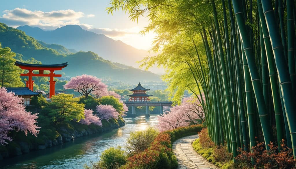
This ancient city stands 65 kilometers north of Osaka and is bounded by three mountains, Higashiyama, Kitayama, and Nishiyama, collectively known as the Yamashiro Basin. This natural surrounding not only insulated the city but also contributed to its unique *climatic conditions*. The elevation provides a cooler climate compared to the coastal areas, which was one of the reasons why the ancient emperors selected it as an ideal capital location, minimizing the threat of foreign invasions from the sea.

Impact of Kyoto’s Geographical Position on Historical Development
The city’s geographic positioning impacted its historical trajectory significantly. Its distinct climate and natural defenses facilitated the rise of a strong, centralized rule, crucial for the long-lasting *Heian period*. Moreover, Kyoto’s proximity to major waterways allowed for efficient trade with other regions, further establishing it as a cultural powerhouse. The benefits extended into the culinary arts, with a readily available variety of ingredients contributing to Kyoto’s unique gastronomy.
- 🌸 Cultural Hub: Proximity to natural resources fueled artisanship and traditional crafts.
- 🚶 Trade Routes: Strategic position along historical trade lines supported economic growth.
- 🌿 Biodiversity: The surrounding mountains fostered diverse flora and fauna.
Exploring Kyoto’s Coordinates: An Urban Planner’s Perspective
Understanding Kyoto’s precise coordinates is essential for both urban planning and tourism development. The city occupies a geographical footprint that influences both infrastructure design and conservation policies. As a city planner, utilizing coordinates facilitates efficient land use and helps in maintaining a balance between urban expansion and preservation of historical sites.
Urban planners often rely on geographic information systems (GIS) to visualize and analyze spatial data. This technology aids in recognizing development patterns, predicting future growth areas, and evaluating potential impacts on the environment. The coordinates 35.0211° N, 135.754° E serve as a reference point in these analyses, ensuring that developments respect Kyoto’s cultural integrity while accommodating modern needs.
Additionally, Kyoto’s geographical information is vital in disaster management. Situated in a region prone to earthquakes and seasonal typhoons, precise coordinates are crucial for emergency planning and designing resilient structures. The role of these coordinates is not just limited to mapping but extends into ensuring the safety and sustainability of the community.
| Aspect | Impact |
|---|---|
| Urban Expansion | Controlled development around historical landmarks |
| Disaster Preparedness | Efficient emergency response through accurate mapping |
| Environmental Conservation | Balancing nature preservation with urban need |
Harnessing Geographic Technology for Tourism
From a *tourism* perspective, knowing the precise coordinates enhances navigational aids for tourists. Landmarks such as Kyoto Imperial Palace and Kinkaku-ji can be easily located using GPS services, providing tourists with optimal routes and a deeper understanding of the city’s layout. These technologies also support interactive guides, enriching the visitor’s experience by integrating historical and cultural narratives with precise locations.
Coordinates of Kyoto Prefecture and Their Importance
The coordinates of Kyoto Prefecture extend beyond the city itself, encompassing a larger area that is rich in cultural and natural resources. The broader prefectural latitude and longitude are approximately 35.1567° N and 135.5252° E. This information is crucial for environmental scientists and conservationists engaged in understanding and protecting Kyoto’s diverse ecosystems.
Kyoto Prefecture enjoys a position that includes lush forests, vibrant water bodies, and farmland that’s crucial for both biodiversity and the local economy. The prefecture’s distinct climatic zones, influenced by its *latitude* and *longitude*, support a range of flora and fauna, making it a case study for ecological sustainability.
More so, these coordinates help in anticipating and mitigating environmental challenges. Initiatives to combat climate change effects and preserve Kyoto’s unique biodiversity rely heavily on geographical data that inform environmental strategies and policies. As a result, the prefecture’s coordinates are more than mere numbers; they embody a commitment to conserving a natural and cultural heritage for future generations.
| Latitude | Longitude | Significance |
|---|---|---|
| 35.1567° N | 135.5252° E | Supports diverse ecological zones |
| 35.0211° N | 135.754° E | Central city planning reference |
The Role of Coordinates in Cultural Preservation
Coordinates play an important role in cultural preservation by establishing protected zones around historical sites such as the Gion District and Nijo Castle. This helps in managing urban development pressures and ensuring that these sites remain undisturbed by modern construction projects. Through innovative use of geographic data, Kyoto can continue to innovate while holding steadfast to its traditional roots.
Navigating Kyoto’s Landmarks: Utilizing Coordinates for Visitors
For a visitor navigating historical landmarks such as Fushimi Inari Taisha or the Philosopher’s Path, understanding Kyoto’s geographical layout can greatly enhance their travel experience. Whether it’s finding the quickest route using GPS or indulging in a scenic walk, precise coordinates offer an unparalleled level of convenience.
Tourists can efficiently plan their itineraries and maximize their experience by integrating geographical data into their travels. Navigational apps, rich in geographic details, ensure that visitors not only find their way effortlessly but also engage more deeply with local culture. Such integration of technology not only enhances the visitor experience but also contributes to the city’s *sustainable tourism goals*.
Secure and Enjoyable Exploration
Safety and enjoyment are paramount for tourists. By employing GPS-based applications and guides, visitors can avoid entering restricted or unsafe areas, adhering to local guidelines and *cultural practices*. Platforms providing real-time updates and information about delays or closures, especially near places like the Kyoto National Museum, enable tourists to adapt their plans dynamically and enjoy a seamless exploration of Kyoto’s beauty.
In conclusion, Kyoto’s geographic coordinates are more than just numbers on a map. They are an essential tool employed by planners, tourists, and conservationists alike, ensuring that Kyoto remains a beacon of cultural and natural beauty for generations to come.
FAQs About Kyoto’s Location and Coordinates
Clear answers to some common questions can further enhance understanding of Kyoto’s geographical context:
- 1. What are the precise coordinates of Kyoto?
Kyoto is located at approximately 35.0211° N latitude and 135.754° E longitude. - 2. How do Kyoto’s coordinates affect tourism?
The geographic data assists with precise navigation and enriching touristic experiences through GPS technology and guided tours. - 3. Are there any conservation efforts tied to Kyoto’s location?
Yes, coordinated efforts are underway to preserve Kyoto’s ecological biodiversity and cultural heritage, benefiting from detailed geographic data. - 4. How do coordinates aid in Kyoto’s disaster management?
Coordinates are crucial for planning resilient infrastructures and emergency responses, particularly in earthquake-prone regions. - 5. Can visitors access Kyoto’s coordinates easily?
Absolutely, most modern GPS devices and mobile apps provide seamless access to Kyoto’s geographic data, enhancing visitor experiences.

Kyoto is more than just a city celebrated for its historical temples and vibrant cultural experiences. Nestled in the heart of Japan, this picturesque region is a harmonious blend of urban progression and natural beauty. Travelers and nature enthusiasts often…
Geographical features of Kyoto
💡 With its history stretching back over a millennium, Kyoto is not only a cultural and historical gem but also a city with fascinating geographical features. Surrounded by mountains and laced with rivers, Kyoto’s landscape plays a crucial role in…

Kyoto is not just a city steeped in rich cultural history and stunning temples; it is a haven of natural splendor, weaving together the tranquility of Japanese gardens with breathtaking wildlife. From cherry blossoms in spring to vibrant autumn leaves,…
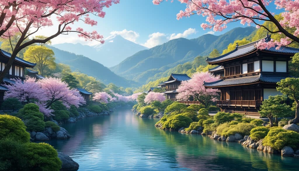
Kyoto, with its rich tapestry of ancient temples and lush gardens, is renowned for its timeless beauty. Yet, this captivating city also holds a network of rivers and waterways that paints a serene picture of traditional and modern life intertwined.…